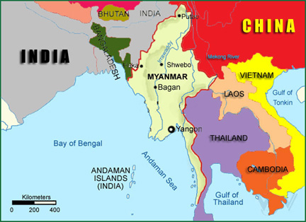
LocationMyanmar is situated in Southeast Asia and is bordered on the north and north-east by China, on the east and south-east by Laos and Thailand, on the south by the Andaman Sea and the Bay of Bengal and on the west by Bangladesh and India. It is located between latitudes 09 32'N and 28 31'N and longitudes 92 10'E and 101 11'E.
GeographyThe country covers an area of 677,000 square kilometers (261,228 square miles) ranging 936 kilometers (581 miles) from the east to west and 2051 kilometers (1275 miles) from north to south. It is a land of hills and valleys and is rimmed in the north, east and west by mountain ranges forming a giant horseshoe. Enclosed within the mountain barriers are the flat lands of Ayeyarwady, Chindwin and Sittaung River valleys where most of the country's agricultural land and population are concentrated.
East longitude 96 13'nd North Latitude 16 45'run through Yangon, the capital of Myanmar. The Myanmar Standard Time, taken as on East Longitude 97 30', is 6 hours 30 minutes ahead of Greenwich meantime. The length of contiguous frontier is 6159 kilometers (3828 miles) and the coastline from the mouth of Naaf River to Kawthaung is 2228 kilometers (1385 miles). The total length of the Myanmar-Bangladesh boundary is 271 kilometers (168.7 miles). It consists of two parts, namely the Naaf River boundary 64 kilometers (39.5 miles) and the land boundary 208 kilometers (129.2 miles). The total length of Myanmar-China boundary is 2204 kilometers (1370 miles); Myanmar-Thailand 2107 kilometers (1309.8 miles); Myanmar-India 1338 kilometers (831.8 miles); and Myanmar-Laos 238 kilometers (147.9 miles).
Climate
The climate of Myanmar is roughly divided into three seasons: Summer, Rainy Season, and Winter Season. From the end of February to the beginning of May are Summer months, with highest temperatures during March and April in Central Myanmar up to above 110F (43.3C) while in Northern Myanmar it is about 97F (36.1C) and on the Shan Plateau between 85F (29.4C) and 95F (35C). Rainy Season, from mid May to the end of October, with annual rain fall of less than 40 inches in Central Myanmar while the coastal regions of Rakhine and Tanintharyi get about 200 inches. Winter which starts from November and lasts to the end of February with temperature in hilly areas of over 3000 feet drops below 32F (0C).
As a whole, the location and topography of the country generate a diversity of climatic conditions. Seasonal changes in the monsoon wind directions create summer, rainy and winter seasons. Extremes of temperature are rare. The direction of winds and depression bring rain, and although it is always heavy in the coastal areas during Monsoon season, it seldom creates hardships. The Government is giving priority to forest conservation and greening of nine arid districts in central Myanmar.
Monthly Average Temperature (C) in Yangon
Jan | Feb | Mar | Apr | May | Jun | Jul | Aug | Sep | Oct | Nov | Dec |
19 | 23 | 29 | 32 | 33 | 33 | 32 | 32 | 30 | 28 | 18 | 16 |
Myanmar is endowed with a rich diversity of habitat types arising largely from its unusual ecological diversity. It is home to nearly 300 known mammal species, 300 reptiles about 100 bird species, and a haven for about 7000 species of plant life. The potential worth of plant species in Myanmar is considerable. Since Myanmar considers such a rich pool of biodiversity as an important national asset, the Government of the Union of Myanmar has drawn up strict regulations to protect its reservoir of biodiversity and biological resources.
Historical Background
Archaelogical findings reveal that parts of Myanmar were inhibited some five thousand years ago. The ancestors of present-day Myanmars, the Pyus and the Mons established several kingdoms throughout the country from the 1st century A.D. to the 10th century A.D. From that early beginning, there are today a fascinating 135 nationalities who call Myanmar home.
Myanmar history dates back to the early 11th Century when King Anawrahta unified the country and founded the First Myanmar Empire in Bagan more than 20 years before the Norman Conquest of England in 1066(i.e. 1044 A.D.). The Bagan Empire encompassed the areas of the present day Myanmar and the entire Menam Valley in Thailand and lasted two centuries.
The Second Myanmar Empire was founded in mid 16th Century by King Bayinnaung(1551-1581). King Alaungpaya founded the last Myanmar Dynasty in 1752 and it was during the zenith of this Empire that the British moved into Myanmar. Like India, Myanmar became a British colony but only after three Anglo-Myanmar Wars in 1825, 1852, and 1885.
During the Second World War, Myanmar was occupied by the Japanese from 1942 till the return of the Allied Forces in 1945. Myanmar has become a sovereign independent state since 4th January 1948 after more than 100 years under the colonial administration.
Religion
The main religions of the country are Buddhism (89.2%), Christianity (5.0%), Islam (3.8%), Hinduism (0.5%), Spiritualism (1.2%) and others (0.2%). Religious intolerance or discrimination on grounds of religion is nonexistent in the Union of Myanmar throughout its long history.
Population
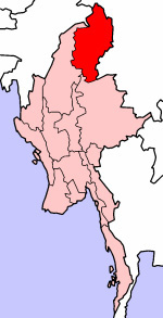
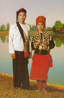
The Union of Myanmar is made up of 135 national races, of which the main national races are Kachin, Kayah, Kayin, Chin, Bamar, Mon, Rakhine and Shan. Population of the country is estimated at 52.4 million (July, 2003) and the population growth rate is 1.84 percent.
8 Major National Races
Composition of 135 Ethnic Groups
Kachin
12
Kayah
9
Kayin
11
Chin
53
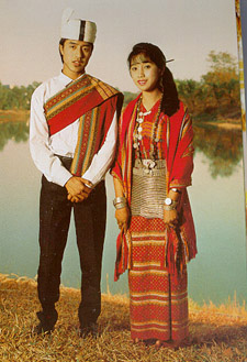
Mon
1
Bamar
9
Rakhine
7
Shan
33
Total
135
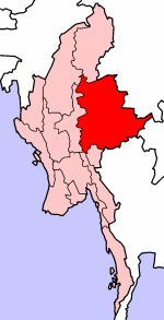
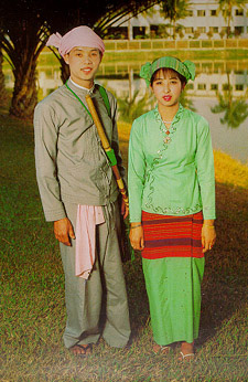
Kachin State and Kachin National
Kayah State and Kayah National
Kayin State and Kayin National
Chin State and Chin National
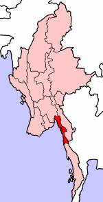
Mon State and Mon National
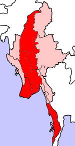
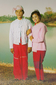
The majority of largest national race “Bamar” live in (7) divisions
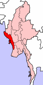

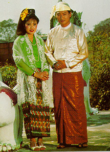
Rakhine State and Rakhine National
Ayeyarwady Division
Bago Division
Magway Division
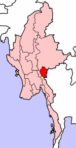
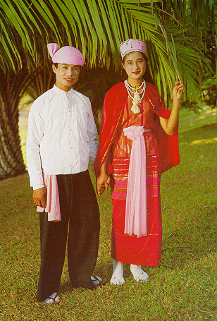
Mandalay Division
Sagaing Division
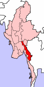
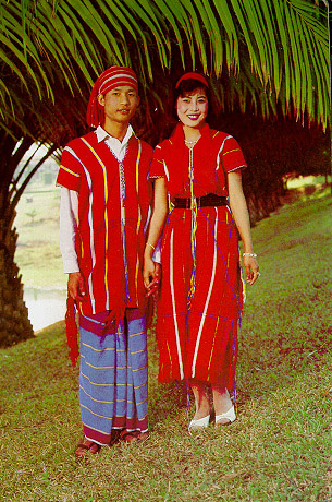
Tanintharyi Division
Yangon Division
Chin State
Kachin State
Kayah State
Kayin State
Mon State
Rakhine State
Shan State
The State Flag
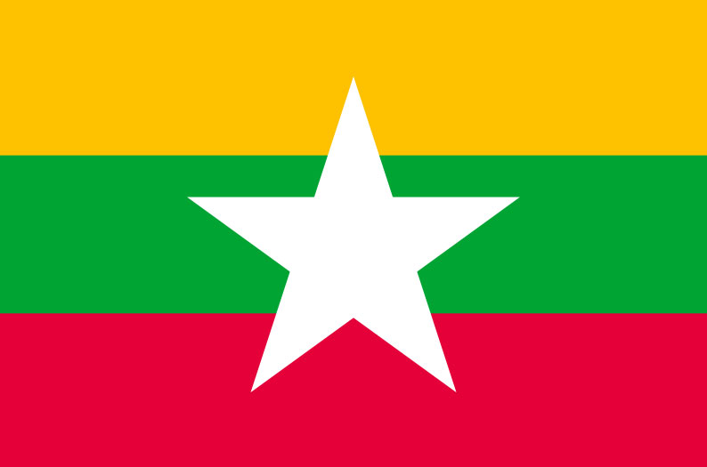
The Republic of the Union of Myanmar, adopted a new state flag on 21 October 2010. The new flag was introduced along with implementing changes to the country's name, which were laid out in the 2008 Constitution. The design of the flag has three horizontal stripes of yellow, green and red with a five-pointed white star in the middle. The three colours of the stripes are meant to symbolise solidarity, peace and tranquility, and courage and decisiveness.
The State Seal
The distinguishing features of the State Seal are as follows:-
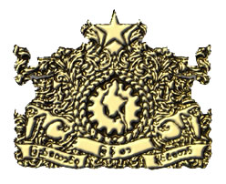
- At the center of the State Seal is a pinion with fourteen equal-sized cogs on which the map of Myanmar is superimposed. The pinion and the map are encircled with two ears of paddy.
- The ears of paddy are flanked on each side by an artistic Myanmar Lion. The lion on the right side faces towards the right and the one on the left side faces towards the left.
- The words "The Union of Myanmar" are inscribed in Myanmar below the lions and the ears of paddy.
- At the top of the State Seal is a star with five vertices.
- Myanmar floral designs are etched on either side of the ears of paddy and the star.